| |
Canary Islands |
|
|

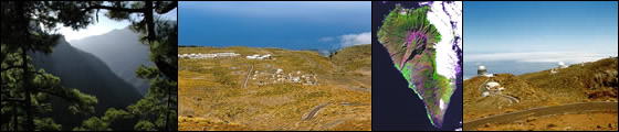
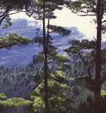
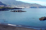
La Palma is excellent for walking trips and can cater for all tastes from a gentle stroll to a strenuous hike. Its varied landscapes, from the volcanic ash region of El Pinar to the lush, almost tropical forests of Los Tilos, fully compensate for the lack of historic sights.
|
|
|
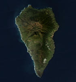
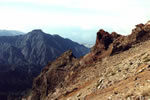
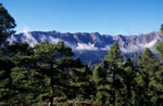
The most important geological feature of La Palma is the Caldera de Taburiente, which dominates the northern part of the island. This is a large depression, 5 km across, with an area of 30 sq km, and 2 km deep. It originated 2 million years ago, with the formation of a shield volcano some 20 km in diameter. However, the Caldera was formed not by the original volcanic activity, but by subsequent erosion. The result is one of the largest and most impressive erosion craters in the world.
|
La Palma lies in both the cool north-easterly Canary current and the north-easterly trade winds, giving it a sunny climate with year-round moderate temperatures, rather cooler than would be expected given the latitude of the island.
Rainfall levels vary substantially across the island. The prevailing north-easterly trade winds bring moisture down to the Canaries, and the high altitude of the island means that most of this is deposited to the north-east. The southern part of the island is relatively dry and sunny.
|
|
|
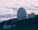
Due to the location of the island and the height of its mountains, some 2.4 km above sea level, a number of international observatories have been built on the Roque de los Muchachos. The particular geographical position and climate cause clouds to form between 1 km and 2 km, usually leaving the observatories with a clear sky. Often, the view from the top of the volcano is a sea of clouds covering the eastern part of the island.
|
|
|
|
|
| |
|
|
|
 |
|
|